Accumulation
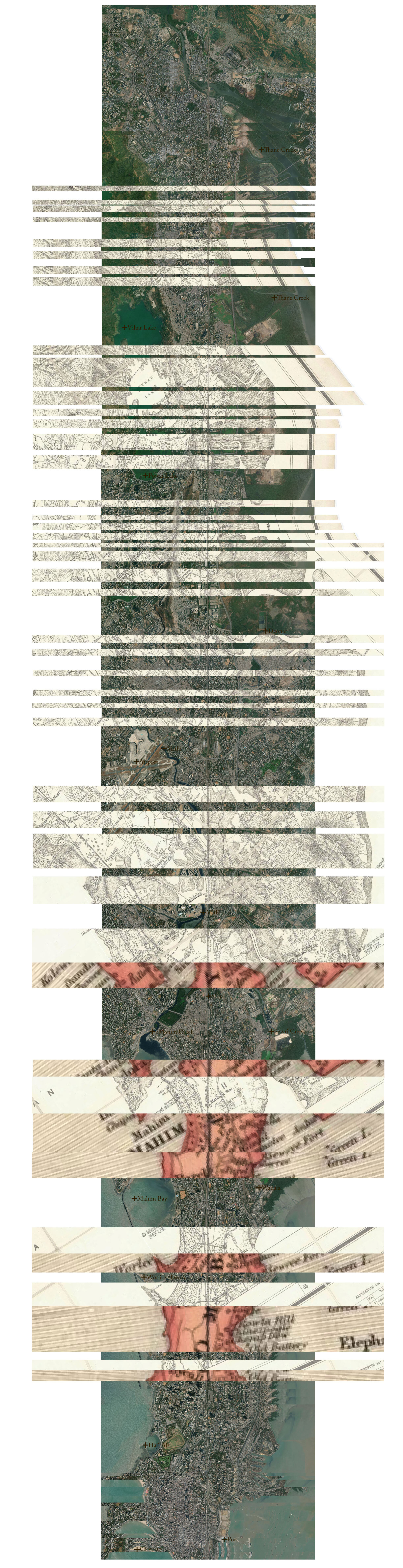
Often described as the lifeline of Mumbai, the local trains cut across the city longitudinally, dissecting her estuaries and wetlands. The building of the railway and the causeways to connect the highlands of the city across the marshes, formed an edge, resulting in the accumulation of silt into viscous thicker waters. A beginning to a long future of landfill and reclamation land.
The drawing straightens the city along its spine / infrastructural coast, splicing it with an 1885 map from the Surveyor General of India, showing the Kurla Sion Railroad. The marshlands in the old map have been hatched solid, claimed as land, while the fine print reveals that they are lands covered with water in high tide. The splice reveals the status of those marshes today, many filled in and built over, the old map constructing the city in the present. The map visually posits a land overcome by high tide, rather than a tide encroached by land, giving birth to the idea of reclamation.